Drone Mapping & Inspection
See More.
Build Better.
Precision drone services for engineers, surveyors, builders, and contractors. 2D mapping, 3D topography, utility inspection, stockpile calculations — and virtually anything else with third-party processing.
What We Deliver
Full-Spectrum Drone Services
From a single tower inspection to a complete site survey with cut/fill calculations — we operate fast, report precisely, and pay for themselves.
Third-party processing means our capabilities are virtually unlimited. If you can describe it, we can map it.
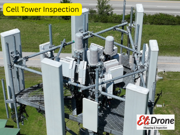
Utility Inspection
Towers, power lines, bridges, and windmills — captured safely and thoroughly from the air.
BIM & Facade
Building Information Modeling — roof and facade inspection with photogrammetric accuracy.
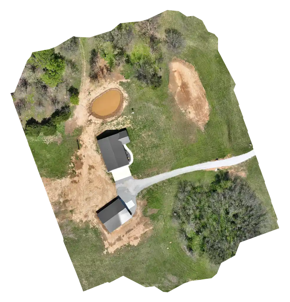
2D / 3D Mapping
Orthographic aerial imagery and fully rendered 3D point cloud models of your site.
Topography
High-resolution terrain models for grading, drainage planning, and engineering design.
Topography
High-resolution terrain models for grading, drainage planning, and engineering design.
Cut / Fill Calculations
Precise earthwork volume analysis. Validate sub-contractor invoices before you pay them.
Construction Monitoring
Progress reports at any interval. Keep clients informed and stakeholders confident.
Thermal Inspection
Solar farm panel efficiency and fault detection using infrared thermal imaging.
Why Eli Drone
Services That Pay For Themselves
Save Time, Money & Effort
Stop scheduling around crew availability. We mobilize fast and deliver actionable data — so your projects keep moving and your clients stay happy.
Subcontract with Confidence
Expand your capacity without adding headcount — and impress clients with technology they didn't know existed.
Validate Before You Pay
Use our cut/fill and stockpile data to verify sub-contractor invoices with precision. Our measurement doesn't lie — and neither should the bill.
Near-Unlimited Scope
Third-party processing means we can handle virtually any deliverable format your project requires. If you can spec it, we can produce it.
Impress Your Clients
Deliver 3D fly-throughs, precise ortho maps, and thermal reports. Show your clients what modern project management looks like.
Never Lose a Client to Speed
Long wait times cost relationships. We move quickly so you can respond fast, stay competitive, and keep every client you've earned.
About Eli Drone
40 Years in The Trades
"Things have changed a lot in the building trades since it all began back in 1985. It's hard to keep up with all the changes."
Now, with the most current technology, continually updated tools, and an amazing team that can handle almost anything, Eli Drone is making life better for the go-getters of this industry.
We’re based in Carthage, Missouri — serving engineers, surveyors, developers, and municipalities across Carthage, Joplin, and Springfield.
Ready to See Your Site from Above?
One call is all it takes. We’ll talk through your project, show you what’s possible, and get you a clear quote — fast.